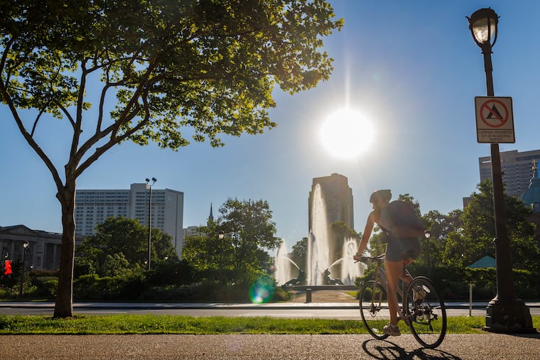
Highs in the 90s around here in early June aren’t all that special, but by the time this weekend is over Philadelphia may have experienced a climatological rarity.
Afternoon temperatures are expect to crest pass 90 degrees on Friday and Saturday, with an outside they make it to 90 on Sunday.
On Friday, 52 Philadelphia School District schools that lack air-conditioning will be closed, with no after-school activities. However, any scheduled field trips will proceed.
The Delaware Valley Regional Planning Commission has posted a code orange air quality alert Friday for the Philly area, recommending that people with respiratory or heart conditions limit time outside.
Philly and the entire Mid-Atlantic region is in for a significant warmup the next few days, said Frank Pereira, senior branch forecaster with the Weather Prediction Center in College Park, Md.
While hit-and-miss showers are possible Saturday night and Sunday, Pereira said they won’t be drought killers.
“it doesn’t look like anything too widespread for heavier amounts,” Pereira said, with the heftier totals well north and west of the region.
Pereira said a cool-down should start the new workweek, but don’t get used to it. The Climate Prediction Center sees the odds favoring above-normal temperatures in Philly for the rest of the month.
This is early for a run of 90-degree days
Officially, Philadelphia had five days in April and May with readings of 90 or higher, something that’s happened only a few times in the period of record dating to 1873 and the dawn of official record-keeping.
If the forecasts hold for Friday and Saturday, that would be seven 90-degree or warmer days this year.
Only twice before have official highs of 90 or better occurred seven times through June 6 in Philadelphia, in 2010, and in 1991, when it reached 90 a record 11 times in May.
While June got off to a temperate start, it follows what was perhaps a surprisingly warm spring.
Despite that killer freeze, spring was one of the warmest on record
Lost in the temperature volatility, which included a widespread crop-killing freeze during the meteorological spring, was the fact that the meteorological spring, the March 1 through May 31 period, was one of the region’s warmest on record.
For Philly, where temperatures averaged 3.7 degrees above normal, it ranked as the third warmest; in Wilmington, No. 4; and Atlantic City, No. 6, according to the Northeast Regional Climate Center.
It also was quite dry in Philadelphia, with precipitation 63% of normal, the 15th driest spring on record.
When will it rain again?
As so often been the case lately, no significant rain is on the horizon.
The region had a rainy period during the third week in May, but precipitation still finished below normal for the 10th consecutive month.
In Thursday’s update, the inter-agency U.S. Drought Monitor had Philadelphia, all of South Jersey and Bucks County, and portions of Chester and Delaware Counties in the “severe drought” zone.
Chester County and all of South Jersey are under state-designated drought emergencies.
Whatever falls during the weekend is unlikely to put a dent in deficits, but, “We’ll take what we can get,” said Patrick O’Hara, meteorologist at the National Weather Service Office in Mount Holly.